![Item #map016 Die Befestigung der westlichen Dardanellen-Eingangs [map]. A. Jahnke.](https://blackpawbooks.cdn.bibliopolis.com/pictures/map016.jpg?width=768&height=1000&fit=bounds&auto=webp&v=1554407158)
![Die Befestigung der westlichen Dardanellen-Eingangs [map]](https://blackpawbooks.cdn.bibliopolis.com/pictures/map016_2.jpg?auto=webp&v=1554407158)
![Die Befestigung der westlichen Dardanellen-Eingangs [map]](https://blackpawbooks.cdn.bibliopolis.com/pictures/map016_3.jpg?auto=webp&v=1554407156)
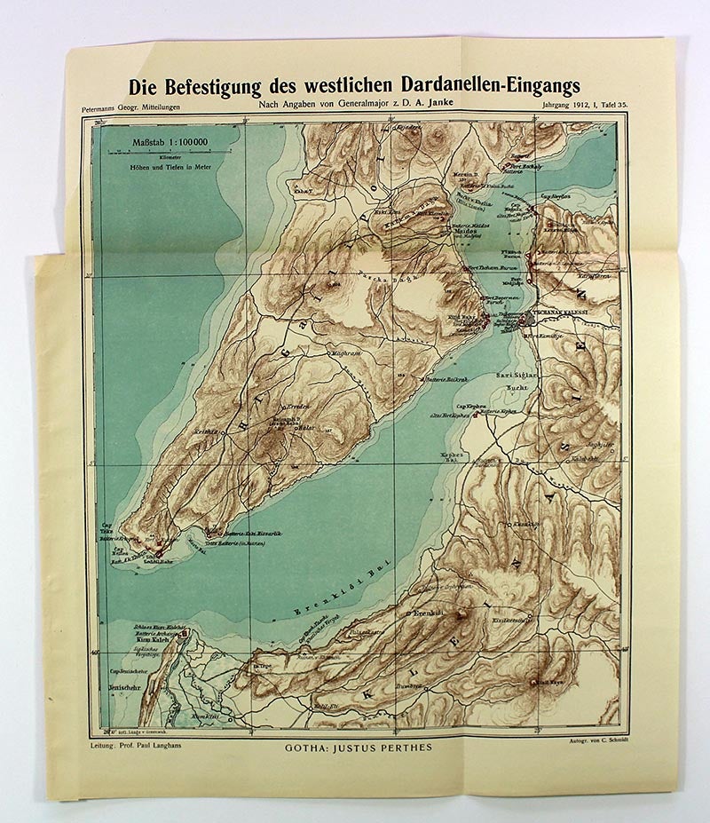
Die Befestigung der westlichen Dardanellen-Eingangs [map]
Dr. A. Petermanns Mitteilungen aus Justus Perthes' Geographischer Anstalt, 1912. original folded map. Very Good. Item #map016
Original folded map entitled Die Befestigung der westlichen Dardanellen-Eingangs by A. Jahnke (Dr. A. Petermanns Mitteilungen aus Justus Perthes' Geographischer Anstalt, 1912). Map is approximately 15 inches tall x 12 inches wide. Scale: 1:100,000. 5 colors. German language map of the Dardanelles defenses during the Balkan Wars. Minor crease to upper left-hand corner of map.
Price: $40.00
See all items in
Ephemera & Maps
See all items by A. Jahnke